Pages

Showing posts with label Picnic Areas. Show all posts

Wednesday, 26 December 2012

CURRUMBIN


Currumbin with its picturesque white beaches and sandy creek banks is one of my favourite places to visit. This superb destination have several well located cafes that offer fabulous ocean and creek views. Currumbin is a suburb on the Gold Coast, a one hour and 40 minutes drive from Brisbane southern suburbs. To get there, drive along the Pacific Motorway and exit at 93 or 95 to arrive at Currumbin.
Currumbin has several popular hot spots; the  Currumbin Alley, the Sandy Bay, The Curumbin Rock , Wildlife Sanctuary and the Currumbin Rock Pools and Mt Cougal National Park located further down the creek.
The Bay is a cracking place for a little sunbathing and swimming. Children are easily entertained by the reasonable sized playground and shallow waters of the bay area. The park amenities include public toilets towards the edge of the lagoon, and contain changing rooms. 
Looking towards the Gold Coast from the far north beach
Located on the northside of the lagoon is a fairly decent cafe providing outside seating for people to relax and enjoy the fresh ocean breeze and the scenery of the bay.
Around the bend of the bay is a delightful boardwalk that winds its way through the mangroves and the sandy creek bank.
High tide is when this boardwalk is at its most spectacular. Fish can be seen swimming in the clear water of the mangrove forest. 
The boardwalk also has special built shelters for fishing enthusiasts. These shelters are also great places to rest and admire the placid creek and the surrounding wildlife activity.
Venture down the Currumbin Creek and you will find a place that hires out boats, canoes and kayaks for a few hours. Next to the boat hire store is a reasonably price cafe that is ideal for a quick bite and a nice coffee or a thick shake!
A popular swimming spot for locals and tourist is the Currumbin Valley Rock Pools.
The Rock Pool is located along Currumbin Creek Road at the intersection of Reynolds Road. If time permits travel further to the end of the road and you will find Mt Cougal National Park. Explore the old Saw Mill and the Currumbin Natural Rockslide.

The Currumbin Alley is a popular surf break often crowded throughout the day. Located at the mouth of the Currumbin Creek, it offers a great place for longboard surfing.

Monday, 25 June 2012

WIVENHOE DAM

Sunday Drive To Lake Wivenhoe

The Wivenhoe Dam (or sometimes called Lake Wivenhoe) is the largest dam in the south east region of Queensland. The dam was completed in 1985.

I have lived in Brisbane for 14 years and had never made the effort to explore Lake Wivenhoe. The lake is very popular with the locals, so on a nice Sunday morning I packed up a picnic and invited a few friends to see for myself  why people flock to  Lake Wivenhoe.

The journey to the lake from Brisbane took about an hour and 15 minutes from the southern suburbs. There are many parks at Lake Wivenhoe so our group decided to stop at the park close to the spillway to visit the Information Center.

Wivenhoe Dam is popular for barbeques, boating, swimming in allocated areas, camping, canoeing, fishing, kayaking, picnicking, sailing, and walking.

On our visit, my friends enjoyed a well packed picnic with glass of white wine and settled in to absorb the tranquil surroundings. After a game of bocce (a mini version of outdoor bowls with different rules) our day was complete.


The Spillway Common (where we picnicked) is a rather large park with plenty of space for a friendly game of cricket, soccer, or rugby amongst mates.


Lake Wivenhoe have a few popular spots to visit, Cormorant Bay, Hamon Cove, Spillway Common and Captain Logan Camp. 

On my next visit to Wivenhoe Dam, I am planning to explore Cormorant Bay after hearing of a restaurant that sits on the banks of Lake Wivenhoe. You will get to see great views from the veranda while enjoying your restaurant meal.


The trip to the lake was a success. My friends and I look forward to our return visit. To gather more information on Lake Wivenhoe follow this link:http://www.seqwater.com.au/public/virtual-tours/pdf/WivenhoeDam_Script_Sheet.pdf


Monday, 28 November 2011

EXPLORING OXLEY CREEK COMMON


  Oxley Creek Common is a large natural wetland. The park borders Oxley Creek to one side and farmland on the other.
The park is accessed via Sherwood Road, Rocklea. Located approximately 14km from Brisbane City.


 A place for large gatherings is possible with many decent size picnic areas.


 Taking a peek inside the red shelter shed

 Nice place to rest in the cool, away from the summer sun

I have a fascination with windmills they seem to add character to a place.
    Which way to go
 The park is popular for bird watching, but is known for canoeing, walking dogs, and jogging. In January 2011 the park was covered by several feet of muddy flood water and as a result was closed off to the public. The main park and walking trail have been restored but unfortunalety the Pelican Lagoon is still closed off to the public.


     the stairs down to canoe platform

  The Canoe platform area . If your are interested in canoeing along the creek, a map for a guide is available at this link; http://www.upstreampaddle.com/oxley.html

 Walking the trail around the creek, looking into the farmland that borders the pathway.


 Oxley Creek Common is a haven for birdlife. 180 known species have been recorded in the park in the past several years. The park even has its own Bird watching guide; The Birding Guide . A list of birds at the park can be found at this link;http://www.uq.edu.au/spatialecology/docs/Hughs_Bird_Files/OCC-AnnotatedList-February-2009.pdf 

 The walking trail goes close to the creek's bank


           The view of the walkway.


  found this plant growing in the grassy field   near the edge of the pathway.


Cattle grazing, daring the heat in the middle of a hot summer day.


Another view of the creek bank.

I was lucky enough to get close to this dragonfly to take the photo.


 Guys walking back from their water rafting adventure. 


  There is a remarkable large number of Butterfly's fluttering around the walking trail, however they are very hard to capture on camera. This photo took me almost an hour. 


Butterfly in mid flight


Tuesday, 8 November 2011

ROCKS RIVERSIDE PARK


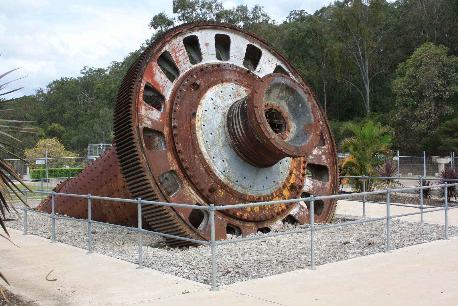
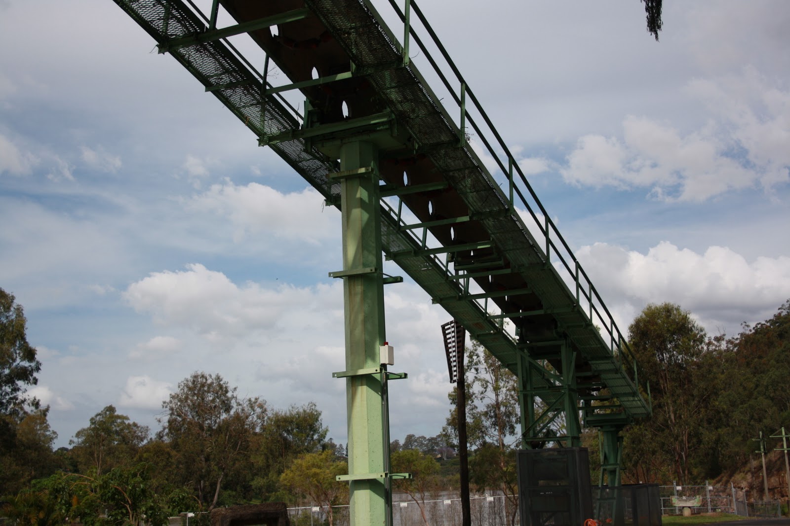
The Rocks Riverside Park was a former Queensland Cement Limited quarry. The park is built on a 26-hectare of reclaimed industrial land. Scattered throughout the park you will find public artworks and industrial debris such as remains of conveyor belts, crushing plant and wharf.


Map of park located at the entrance


In the south west of Brisbane at Seventeen Mile Rocks is the Rocks Riverside Park. This huge park  has a wide range of features including a market garden, bushland range, river flat and dry eucalypt forest. 
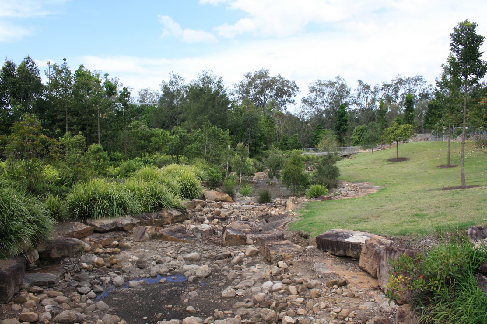
Man - made rock creek that flows into the Brisbane River


The Park was badly affected by the Queensland January 2011 floods and some areas of the park are currently closed for safety reasons. The Brisbane City Council have commenced restoring the park and work is expected to be completed by late 2011.

 I was lucky on the day that hardly anyone was around and was undisturbed as I happily took photos. Best time to visit is Monday to Friday.


The Bird looks interested in what I am doing. So cute.


Standing on a bridge looking over the rock creek, you almost  feel that you have ventured into Australian Bushland.


                      The view of the river from the parkland


The park borders the Brisbane River... a great place to sit and watch the life of the river.


 Brisbane River is great for water activities


Throughout the park there are a number of industrial artifacts, but I am not sure what this is...maybe a kind of drill part.


The remains of the conveyor belt from the concrete quarry.


     Close up ...Looks like part of a drill.

   Interesting looking artifact


There are several shelter areas located throughout the part but perhaps this one is the nicest...lovely view of the river with great BBQ facilities.


    A drill part perhaps!


 Conveyor Belt  going towards the wharf


    Crusher Pavilion


 Another view of the Conveyor Belt


    Another garden to admire


                   Tree growing on a rock


   Place to rest before walking the track up the mountain side...


                birds flying above ....


    Like this art work....Garden bed in shape of boat


    There are birds everywhere in this park


 looking towards the sport field located at the front of the park.
 

      yet again another bird...


    Bird In Jasmine Tree


Not really sure what berry this is.....was growing amongst the lillies


    Looking out towards the entrance


 more information on this park visit this link; http://www.brisbane.qld.gov.au/facilities-recreation/parks-gardens/parks-by-suburb/Flood-affected-community-parks/Riverside-Parks-Flood-Recovery/Rocks-Riverside-Park/index.htm

A detail map of the park then go to this link; http://www.brisbane.qld.gov.au/2010%20Library/2009%20PDF%20and%20Docs/6.Facilities%20and%20Recreation/6.3%20Parks%20and%20gardens/rocks_riverside_park_map_reduced.pdf